Most experts agree that humans first appeared on Earth around 6 million years ago. It was not until the turn of the 19th century that the world’s population reached 1 billion. Fast forward a little over 200 years to the present day and we now have more than 8 billion people on the planet. In both industrialised and emergent nations alike, we are all having to live with never-ending development. This is resulting in more infrastructure, more vehicles, more pollution, more climate extremes,…………. and countless more people.
I would guess that many of us have dreamed at some time or other of escaping to a remote corner of the planet. However, how different is the reality of being cut off from the rest of the world, different from our preconceptions? Here’s a brief narrative of life in five of the world’s remotest inhabited places:
Tristan da Cunha
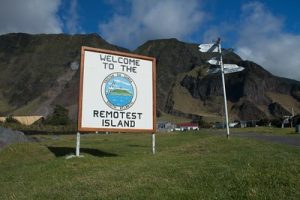
Photo credit: Flickr/CC by 2.0 Deed
The British territory of Tristan da Cunha is a remote archipelago in the South Atlantic Ocean. The main island, Tristan da Cunha, has a diameter of approximately 11 km (7 mi) and an area of 98 km2 (38 sq mi). The island is widely recognised as the remotest permanent settlement on earth. The nearest neighbour to Tristan is the tiny South Atlantic island of St. Helena, 2,160 km (1,350 mi) away. South Africa’s Cape Town lies approximately 2,800 km (1,750 mi) due east.
In March 2024, the total population of Tristan da Cunha was officially recorded as 238. Edinburgh (of the Seven Seas) is the capital and the archipelago’s only sizeable settlement. The island has no restaurants, hotels or airport. The only way to get to Tristan da Cunha is via a 6-day boat trip from Cape Town, weather permitting. The Island’s economy is based on subsistence fishing and farming, a small degree of tourism and the overseas sale of stamps and coins.
Pitcairn Island
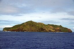
Photo credit: Wikimedia/CC BY-SA 4.0
The British-held territory of the Pitcairn Islands is a group of four volcanic islands in the Southern Pacific Ocean. However, it is only the 5 sq km Pitcairn Island itself that is inhabited. The French Polynesian island of Mangariva, some 480 km (300 mi) to the northwest is the nearest inhabited island. The New Zealand coast lies more than 5,500 km (3,440 mi) due southwest.
Pitcairn has the distinction of being the world’s smallest democracy. Almost all islanders are directly descended from the notorious HMS Bounty mutineers of 1790 and their Tahitian companions. The island’s only settlement, Adamstown has a permanent population of less than 50. Nonetheless, it boasts a post office, a government Treasury Office, a general store, a school, a library and a medical centre.
The Island’s economy is based on subsistence fishing and farming, a small degree of tourism and the overseas sale of stamps and coins. The only way to get to Pitcairn is via boat. A scheduled sailing from Mangareva takes place every 2 weeks. Alternatively, freight ships bringing supplies to the island sail intermittently from New Zealand.
Easter Island
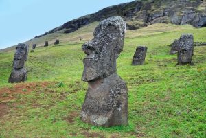
Photo credit: PICRYL/PDM 1.0 Deed
Easter Island, also known as Rapa Nui, lies approximately 3680 km (2,300 mi) off the coast of Chile. The Chilean territory was named by Dutch explorer Jacob Roggeveen. He happened to land there on the Easter Sunday (5 April) of 1722. Easter Island’s nearest inhabited neighbour is the tiny Pitcairn Island some 1900 km away. The next nearest is the French Polynesian Gambier island of Mangareva more than 2,600 km.
In 2023, the population of the 164 sq km Easter Island was estimated at 8,600. The number has more than doubled in the last 20 years. The dramatic population growth is mainly due to immigration from the Chilean mainland. A rapidly growing population has fuelled high inflation on the island. Thus, measures are now being implemented to try to bring both under control. About 50% of the population are indigenous Rapa Nui, while the rest are of either Spanish or Chilean Indian descent. Around 95% of the population resides in or close to the Island’s only town of Hanga Rao.
Easter Island’s economy relies on a mix of agriculture, fishing, government services, transportation and tourism. The island’s biggest attraction is its 900 monolithic (Moai) statues. The indigenous Rapa Nui people erected the rock sculptures 500 – 800 years ago. In 1995, Easter Island was declared a UNESCO World Heritage site in recognition of its unique monuments. The Island is most readily accessible by flight or via cruise ship. However, the only flight connecting Easter Island’s airport to the mainland is via Chile’s capital city, Santiago.
Oymyakon, Russia
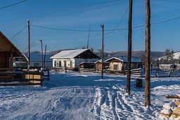
Photo credit: Wikimedia Commons
The Siberian village of Oymyakon is located in the Oymyakonsky District of the Sakha Republic. The nearest sizable settlement is the city of Yakutsk, some 860 km (540 mi) due west. The villagers have the distinction of living in the coldest inhabited place on Earth. Mean daily minimum temperatures are close to -50°C (-58°F) and are routinely experienced during the winter. The lowest temperature officially recorded was -68°C (-90°F) on 6 February 1933, though a few unsubstantiated readings are even lower.
The village grew up around the local airfield constructed during World War II. It was part of the Alaskan-Siberian air route used to ferry supplies to the Eastern Front. The population of Oymyakon once stood at 2,500 but has dwindled over the last few decades to today’s 500 (April 2024). The village’s extreme northerly location means its residents experience up to 21 hours a day of darkness during winter. Consequently, the village has up to 21 hours of daylight in the summer months. The hostile climate means planes can’t land during the winter, leaving the alternative as a risky two-day drive from Yakutsk.
Frozen conditions are present for 8 months of the year around Oymyaxon. This means very few crops can be grown in the locality. Thus, villagers have a largely carnivorous diet, where reindeer meat, ox meat, fish and horse milk form the staples. Indoor plumbing often freezes for long periods and cars need to be kept in heated garages. The local economy is largely based around the fur trade and ice fishing.
Ittoqqortoormiit, Greenland
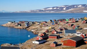
Photo credit: Flickr/CC BY-NC-ND 2.0
Ittoqqortoormiit is a settlement in the Sermersooq municipality of Greenland. It is the only settled place in Northeast Greenland and is located 500 km inside the Arctic Circle. The nearest town is Tasiilaq which is around 800 km (500 mi) to the south. The name “Ittoqqortoormiit” translates to English from the local language as “Big-house dwellers”. The tundra climate means that villagers experience bitterly cold winters and chilly summers. With an average annual temperature of −5°C (23°F), it is one of the coldest permanently settled locations on the planet.
Ittoqqortoormiit was founded in 1925 by the Danish polar explorer and writer, Ejnar Mikkelsen and some 80 Inuit settlers. The village is currently home to some 450 Greenlanders who eke out a living from fishing and hunting. The region is also noted for its wildlife. This has helped to make the village a centre for adventure tourism, increasingly important to the local economy.
There are only 150 km of road in the whole of Greenland, none of which is in the Sermersooq municipality. Ittoqqortoormiit’s transport needs are served by Nerlerit Inaat Airport, located 40 km (25 mi) away. Helicopters provide a shuttle service between the airport and the village heliport. Two flights a week from Reykjavík and Akureyri arrive at Nerlerit Inaat. Boat transfers to Ittoqqortmiit are also possible during the summer months.
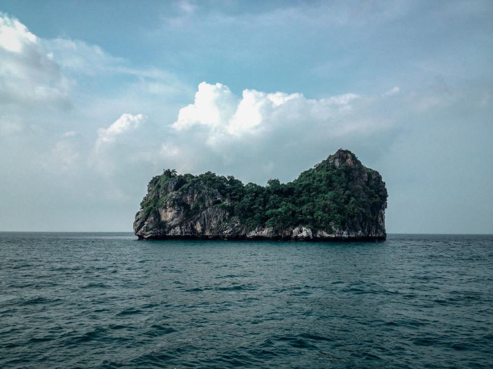
Header photo credit: Freerange Stock/CC0 1.0 DEED


")