The High-life
You might well know that the small island nations of Tuvalu, the Maldives, the Marshall Islands and Kiribati have an average elevation of 2 m or less above sea level. This obviously makes them the lowest-lying nations on the planet. On the contrary you might not know those countries whose populations are literally living the high-life.
Here are a few (interesting) geographical facts on those countries of the world with the highest average elevations:

Photo credit: Flickr/CC BY-NC-ND 2.0
No. 5 – Lesotho
The landlocked Kingdom of Lesotho is an enclave of South Africa and covers a total area of 30,355 sq. km. Situated in the Drakensberg-Maloti mountain range, Lesotho has an average elevation of 2,161 m (7,090 ft). The country has the highest average elevation of all those on the African continent and the fifth highest globally. Located in eastern Lesotho, the Thabana–Ntlenyana mountain (3,482 m or 11,424 ft) is the highest peak in southern Africa.
No. 4 – Kyrgyzstan
Kyrgyzstan is a landlocked country in Central Asia and situated in the Tian Shan and Pamir mountain ranges. The country is bordered by Kazakhstan to the north, Uzbekistan to the west, Tajikistan to the south, and China to the east. Covering 199,951 sq. km, the average elevation of Kyrgyzstan is 2,988 m (9,803 ft). Found in the Tian Shan mountain range, Jengish Chokusu, at 7,439 m (24,406 ft), is the country’s highest peak.
No. 3 – Tajikistan
Tajikistan is a landlocked country in Central Asia that covers a total area of 143,100 sq. km. The country is bordered by Afghanistan to the south, Uzbekistan to the west, Kyrgyzstan to the north, and China to the east. The average elevation of Tajikistan is 3,186 meters (10,453 ft). The country’s maximum elevation (5,510 m/18,077 ft) can be found in the Turkestan mountain range in western Tajikistan.
No. 2 – Nepal
Nepal is a small landlocked country in South Asia which has a total area of 147,516 sq. km. While a small part is located on the Indo-Gangetic Plain, the remainder is situated in the Himalayas. The country borders the Chinese-held region of Tibet to the north, and India to the south, east, and west. The average elevation of Nepal is 3,265 m (10,712 ft). Mount Everest, at a height of 8,850 m (29,035 ft) is the world’s highest mountain and is located on the Nepal/Tibet border.
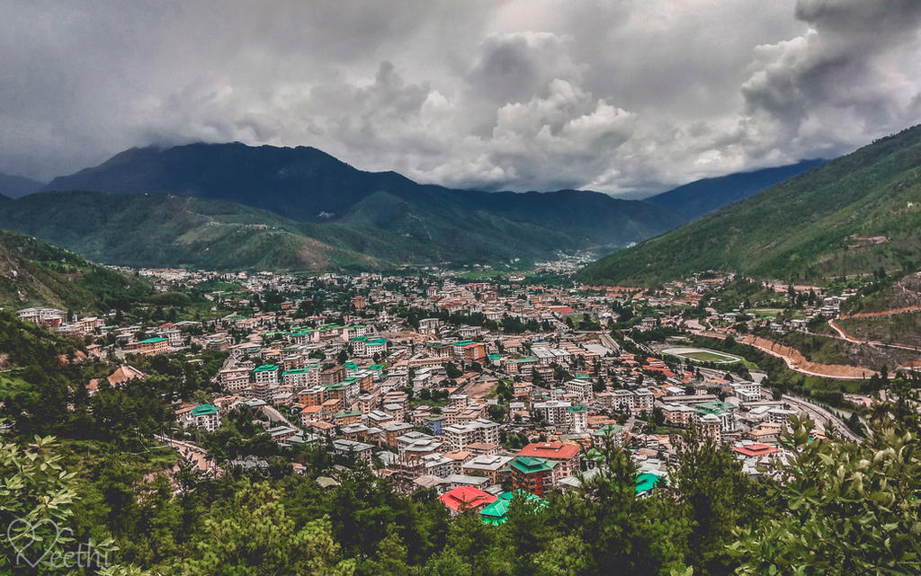
No. 1 – Bhutan
The landlocked Kingdom of Bhutan just tops Nepal as the country with the highest average elevation of any country in the world. The country is situated in the Eastern Himalayas between China in the north and India in the south. The average elevation of the 38,394 sq. km of Bhutan is 3,280 m (10,761 ft). The country is also home to Gangkhar Puensum Mountain. At a height of 7,571 m (24,840 ft), it is the world’s highest unclimbed summit.
Country average elevations are according to The World Factbook (2024): CIA
Header image credit: Preethi524/CC BY-NC-ND 3.0


")


